


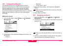

Setup
Leica GS20 Field Guide-1.1.0en
71
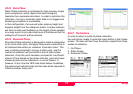
•The DOP, or Dilution of Precision Filter is user definable
mask based on satellite geometry. This is a setting
normally used for autonomous (i.e. correctionless)
collection.
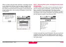
9.6.2 Minimum Satellites
The Minimum Satellite control allows the user to define how
many satellites must be tracked to calculate a positions. The
default setting is 4 satellites, because a minimum of 4
satellites is necessary to calculate a 3 dimensional position.
)
Three satellites can calculate a position assuming
a fixed ellipsoidal elevation; however this is only
recommended for navigational purposes.
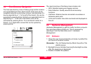
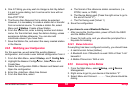
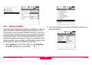
9.6.3 Antenna Type
By default, each configuration is set to the internal patch
antenna of the Leica Geosystems GS20. However, because
external antennas can be connected, it is necessary to define
the parameters unique to a given antenna.
A default library of 3 antenna types is available, the Leica
Geosystems GS20 Internal, the AT501 Pole (external), and
the AT501 Tripod (external). For normal use, the user will only
need to define the height of antenna above the point be
occupied.
Tip: The Leica Geosystems GS20 automatically senses
when an antenna has been plugged in or unplugged.
The unit opens and resets the antenna configuration
accordingly.
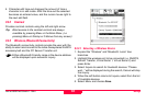
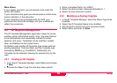
9.6.4 Logging
The Logging screen contains controls to store raw pseudo-
range data for post-processing, Static and Moving
Observations as well as set the positional update rate for the
receiver (default 1 second.)
)
Data collected without enabling the logging cannot
be post processed for corrections!
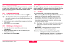
To Enable Post Processing, select the static or moving check
box and set the observable logging rate. This rate controls
both moving and static logging rates, so it is recommended
that 1 second be used when collecting lines and areas in a
job.