


Data Management
Leica GS20 Field Guide-1.1.0en
37
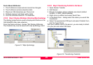
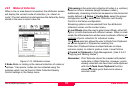
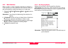
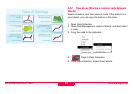
3.2.1.1 Table Filtering
As previously discussed in chapter 1.5.4 "Tables and
Filtering", Table Filtering provides a way to search based on:
• Code (Feature Name)
• Feature Type (i.e. Point, Line or Area)
• Code/Feature Name (using wildcards)
• Range of Time
• Waypoint Status
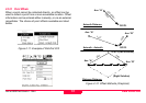
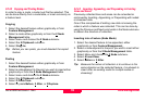
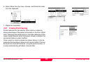
Once data has been filtered, the user can either manipulate or
select based on the filtered table, or display the filter in the
map using the context menu choice Tabled Features and
Highlight. The Traverse submenu choice, allows the user to
graphically progress through each filtered table feature row by
row.
Remember: Filtered data is shown by a bold outline and can
be progressed through using the feature Next
and 2
Previous submenu choice.
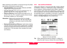
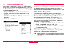
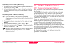
3.2.2 Selecting a Node or “Vertex”
3.2.2.1 Node Management
Node Management can be selected from the context menu
when nothing is selected, providing a list of all nodes in a job.
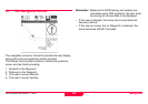
3.2.3 Feature Submenu
When an object is selected at the feature level, the Feature
Submenu provides the user with the ability to
1. Move to the Next and 2
Previous feature when multiple
objects are selected.
2. 3 Copy a feature to Clipboard.
3. 4
Select from Clipboard when a feature has been
previously copied (such as in Navigation).
4. 5
Delete the selected feature.
Remember: Leica Geosystems GS20 does not have Undo!
5. Set a database flag indicating the feature is a Waypoint
and if it has been visited via the 6
Waypoint submenu.