


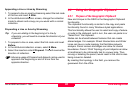


Job Management
Leica GS20 Field Guide-1.1.0en
48
5.1 Coordinate Systems
5.1.1 Introduction
Although the GS20 stores all GPS data in a WGS84
geographic coordinate format, it is possible to translate your
data into a local datum, projection, or coordinate system. A
pre-defined coordinate system is usually made up of
1. An ellipsoid: or a spheroid created to model the earths
surface
a. If different from WGS84, a translation is necessary for
orientation
2. A Projection: or a means to transform a spherical surface
to a 2 dimensional grid
a. Cones and Cylinders are the most common forms of
projection
3. A transformation: or a shifting of the system
a. 3 dimensional transformations involve both Cartesian
X,Y,Z shift, as well as a rotation and scaling factor
b. 2 dimensional transformation usually involve an
Euclidean X,Y shift, as well as a rotation, and scaling
factor. The Z value, perpendicular to the XY plane can
also be shifted.
4. Geoid: or an equipotential surface which coincides with
mean-sea level, and which may be imagined to extend
through the continents. This surface is everywhere
perpendicular to the direction of the force of gravity
a. The geoid is also an interpolation file, and is based on
a grid network of gravity reading. Usually this type of file
is local to a geographic region, such as a country or
continent.
5. CSCS: or Country Specific Coordinate System is an
interpolation file that estimates nonlinear error between
known points with both WGS and local coordinate values
a. These CSCS can be geographic. Cartesian or local grid
in nature. An example of this is the NADCON or North
American Datum Conversion.