Honeywell
MK VI MK VIII EGPWS Installation Design Guide
Proprietary notice on title page applies
CAGE CODE: 97896 SCALE: NONE SIZE: A DWG NO: 060-4314-150 REV:
SHEET
63
3.5 Category 3 – Position Input Select
Category 3 defines the Global Position System bus type and interface. The EGPWS requires a GPS with 8
channels minimum and RAIM capability.
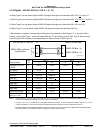
Appendix E Table 5.3.3 defines the Position Input Select options and identifies the first MK VI/VIII EGPWS
version in which the option was available (see the Effectivity entry).
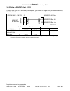
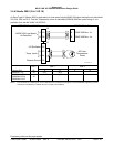
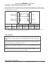
Appendix E Tables 5.3.3-x, where x is the Position Input Type number, define the label set and electrical
interface required to support each Position Input Type.
GPS Input selection is available in the following formats: ARINC 429 low speed, ARINC 429 high speed, RS-
232, and Internal.
The Internal GPS uses ID 2. A unit equipped with an internal GPS (965-1190-XXX and 965-1220-XXX) may
use an external GPS source.
See Category 7 to select GPS Altitude Reference (mean sea level or WGS-84) for ARINC 429 label 076.
3.5.1 ARINC 743 Format
This option provides the ability to specify the GPS input data format as ARINC 743 instead of the ARINC 743A
data format. For ARINC 743A the VFOM is in feet and the HFOM is in nautical miles (nm). For ARINC 743 both
VFOM and HFOM are in meters.
Note: Universal UNS-1 C/D/K/M GPS only, output is in ARINC 743 format.
3.5.2 GPS Altitud e (Label 076) Reference
The GPS Altitude (label 076) may be referenced to mean sea level or WGS-84. Determine which reference your
GPS position uses and program the GPS Altitude Reference accordingly in Category 7.
Note: Universal UNS-1 C/D/K/M GPS only, output the Altitude Label 076 referenced to WGS-84.
3.5.3 North-Sout h East-West Velocity labels
ID’s 10-13 and 253 are provided to support GPS interfaces that do not provide North-South East-West Velocity
labels 166 & 174. ID’s 0,1,4,5, and 255 are preferred.


