Honeywell
MK VI MK VIII EGPWS Installation Design Guide
Proprietary notice on title page applies
CAGE CODE: 97896 SCALE: NONE SIZE: A DWG NO: 060-4314-150 REV:
SHEET 156
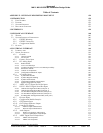
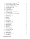
6.2.10 Horizontal Figure Of Merit (247) – GPS (ARINC 743A) 279
6.2.11 Horizontal Figure Of Merit (247) – GPS (ARINC 743) 279
6.2.12 Horizontal Figure Of Merit from HDOP (101) – GPS (ARINC 743) 279
6.2.13 Vertical Figure Of Merit (136) – GPS (ARINC 743A) 279
6.2.14 Vertical Figure Of Merit (136) – GPS (ARINC 743) 279
6.2.15 Vertical Figure Of Merit from VDOP (102) – GPS (ARINC 743) 279
6.2.16 Sensor Status (273) - GPS 280
6.2.17 Universal Time Correlation (125) - GPS 280
6.2.18 Date (260) - GPS 280
6.2.19 Control Word (154) - MFD 281
6.2.20 Control Word 2 (271/273) 281
6.2.20.1 Control Word 2 (271/273) Type 2 281
6.2.21 Discrete Word (155 or 176) - MFD 282
6.2.22 Hazard Range Output (077) 282
6.2.23 Range (050) - Multifunction Signal Generator (MG) or IC600 283
6.2.24 Query / Continuous Response (011) - KCPB 283
6.2.25 Key Press Data (012) – KCPB 284
6.2.26 Control Word 1 (270) 284
6.2.27 Discrete Word (273) – Bendix Weather Radar Vertical Profile Mode 285
6.2.28 Discrete Word (275) – IC600 only 285
6.2.29 Radio Altitude (164) 285
6.2.30 Glideslope Deviation (174 or 117) 285
6.2.31 Roll Angle (325) 286
6.2.32 Magnetic Heading (320) 286
6.2.33 Localizer Deviation (173 or 116) 286
6.2.34 Pitch Angle (324) 286
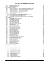
6.2.35 Range (271) - KCPB 286
6.2.36 DSU Status Word (350) 286
6.2.37 True Heading (314) 287
6.2.38 Corrected Barometric Altitude (204) 287
6.2.39 Computed Airspeed (206) 287
6.2.40 True Airspeed (210) 287
6.2.41 Decision Height (370) – IOC Scaling 287
6.2.42 Normal Acceleration (333) 287
6.2.43 Longitudinal Acceleration (331) 288
6.2.44 Left Body Angle of Attack (224) 288
6.2.45 Right Body Angle of Attack (225) 288
6.2.46 VOR/ILS Frequency (034) 288
6.2.47 PFD Mode Select Word (163) 288
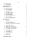
6.2.48 FWC & GP Discrete Word (171) 289
6.2.49 Body Pitch Rate (326) 290
6.2.50 Body Roll Rate (327) 290
6.2.51 Minimum Descent Altitude (170) – IOC Scaling 290
6.2.52 Normal Angle of Attack (236) 290
6.2.53 North/South Velocity (166) - GPS 291
6.2.54 East/West Velocity (174) - GPS 291
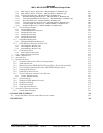
6.2.55 Discrete Word (017) - KMD 550/850 291
6.2.56 Inertial Vertical Speed (365) 291
6.2.57 Inertial Altitude (361) 291
6.2.58 Vertical Velocity (165) - GPS 291
6.2.59 Latitude Fine (120) - GPS 292
6.2.60 Longitude Fine (121) - GPS 292
6.2.61 Selected Course (100) - IOC 292
6.2.62 DH/MDA Selected (170) – DAU Scaling 292
6.3 D
IGITAL DATA, ARINC 575 292
6.3.1 Static Air Temperature (213) 292
6.3.2 Uncorrected Barometric Altitude (203) 293


