


WARNING:No national hydrographic ofce has veried the information in this product or quality assured it, and none accept liability for
the accuracy of reproduction or any modications made thereafter. No national hydrographic ofce makes any warranties or representations,
express or implied, with respect to this product. No national hydrographic ofce warrants that the product satises national or international
regulations regarding the use of the appropriate products for navigation or that it contains the latest hydrographic information available.
WARNING:All charts are digitized directly from existing government and other ofcial charts and should not be used solely for navigation.
Digital charts are intended to be used as an aid to traditional navigational charts, not as a replacement. Only ofcial government charts and
notices to mariners contain all information needed for the safety of navigation, and as always, the captain is responsible for their prudent
use. A prudent navigator never relies on any single source of navigational information. Garmin strives to provide its customers with the most
economical, accurate and up-to-date electronic maps available. However, features are continually changing, so the data may not reect the latest
modications and/or additions in your area. Garmin makes no warranty as to the accuracy or completeness of the map data.
WARNING:Garmin BlueChart data and bottom information are for navigation reference only, as bottom conditions are continually changing.
This product is for general reference.
WARNING:Some of the information in this product may have been produced, in part or whole, from withdrawn national hydrographic ofce
products. New charts and/or NTM corrections will render this product obsolete and inaccurate.
WARNING:The Great Barrier Reef Marine Park Authority (“the Authority”) does not check the information in this product and accepts no
liability for the accuracy of copying or for any modications that may have been made to the information which it has supplied. Use of and
entry to the Great Barrier Reef Marine Park is controlled by the Great Barrier Reef Marine Park Act 1975 (Cth) (“the Act”). Penalties apply
for use of or entry to a zone for a purpose other than for a purpose permitted under the Great Barrier Reef Marine Park Zoning Plan 2003 (“the
Zoning Plan”) prepared by the Authority pursuant to section 32 of the Act. This product does not contain all information concerning permitted
use or entry under the Zoning Plan. For purposes of use of or entry to the Great Barrier Reef Marine Park, this product should only be used in
conjunction with the Zoning Plan and the Great Barrier Reef Marine Park Regulations 1983 (Cth). For purposes of navigation, users should
consult ofcial navigation charts released by relevant government authorities.
WARNING:The Licensee is hereby advised of the Canadian carriage regulations applicable to Canadian ships in all waters and to all ships in
waters under Canadian jurisdiction which requires the master and owner of every ship to: have on board, in respect of each area in which the
ship is to be navigated, the most recent editions of the charts, documents; or to have sufcient knowledge of specic information, such that safe
and efcient navigation in the area where the ship is to be navigated is not compromised.
WARNING:The tide and current predictions derived from this software are not to replace the Canadian Tide and Current Tables, which are
required under the Charts and Nautical Publications Regulations of the Canada Shipping Act and which must be used for navigation within
Canadian waters. Ofcial Canadian Tide and Current Tables are available from authorized chart dealers. For a complete list of dealers in your
area, please contact:
Chart Distribution Ofce
Canadian Hydrographic Service
615 Booth Street
Ottawa, Ontario, K1A 0E6
Telephone: (613) 998-4931
Fax: (613) 998-1217
Email: chs_sales@dfo-mpo.gc.ca
WEB: www.charts.gc.ca
Although CHS produces the tide and current constituent data used in this software with the greatest care, neither Canada, its ministers, ofcers
and employees, nor CHS, who individually and collectively shall hereinafter be referred to as “Canada”, make any representation or warranty,
either express or implied, concerning the accuracy of the Canadian data, or that it is suitable for any particular application or purpose. In
no event will Canada be liable for any damages whatsoever, including but not limited to loss of revenue or prot, lost or damaged data, and
expenses, arising in any way from or consequential upon the use of, or the inability to use this Canadian tide and current constituent data.
Tide and current predictions derived from this software may not be used commercially without a license from Canadian Hydrographic Service,
Department of Fisheries and Oceans. Please contact the Canadian Hydrographic Service’s Chart Distribution Ofce at the above address for
more information.
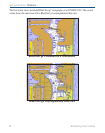
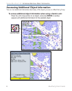
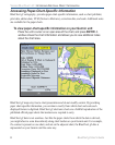
EXPLORER CHARTS
R