


10
BlueChart g2 User’s Guide
vIewIng bluechart g2 > vIewIng tIde and current InformatIon
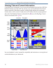
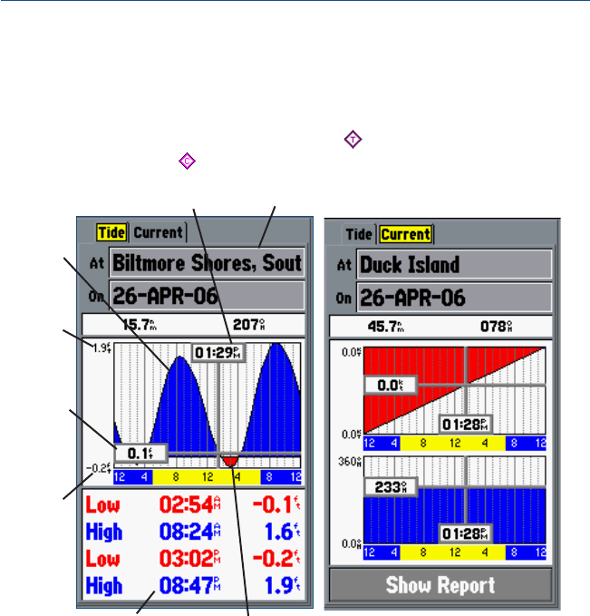
Viewing Tide and Current Information
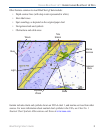
Using BlueChart g2 cartography, you can access tide information from more than 3,000 Tide
Prediction Stations across the world. You can also access current information from Current
Stations around the United States coastline, including Alaska and Hawaii (on preloaded
Garmin units) as well as western Canada and several Caribbean islands (on preprogrammed
data cards). Tide Prediction Stations are denoted with a icon on the Map Page; Current
Stations are indicated with a icon.
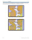
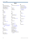
Tide station
Event times
Min.
level
Max.
level
Local time
High
tide
curve
Low tide curve
Tide
height
See your chartplotter’s owner’s manual for compatibility and instructions on viewing tide and
current information on your Garmin unit.