


5
BlueChart g2 User’s Guide
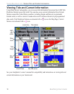
vIewIng bluechart g2 > understandIng bluechart g2 data
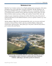
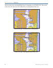
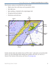
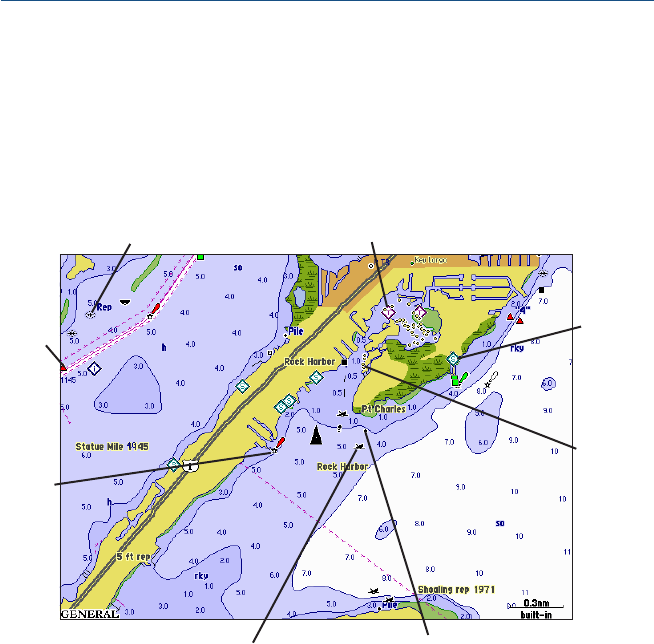
Other features common to most BlueChart g2 data include:
• Depth contour lines (with deep water represented in white)
• Inter-tidal zones
• Spot soundings, as depicted on the original paper chart
• Navigational aids and symbols
• Obstructions and cable areas
Tide
Station
Exposed
Wreck
Exposed
Rock
Wreck
Light
Marina
Services
Buoy
Stake
Garmin includes charts and symbols shown on NOAA chart 1, and marine services from other
sources. For more information about nautical chart symbols in the USA, see Chart No. 1
Nautical Chart Symbols Abbreviations and Terms at www.noaa.com.