GPSMAP 3006C/3010C Owner’s Manual 43
MaIn Pages > 3d hIghwaY Page
MaIn
paGes
Changing the Highway Perspective Range
You can zoom the highway perspective range in or out to show a larger or smaller
view of the highway.
To change the highway perspective range:
PresstheRANGEUpkeytozoomout,orpresstheRANGEDownkeyto
zoomin.
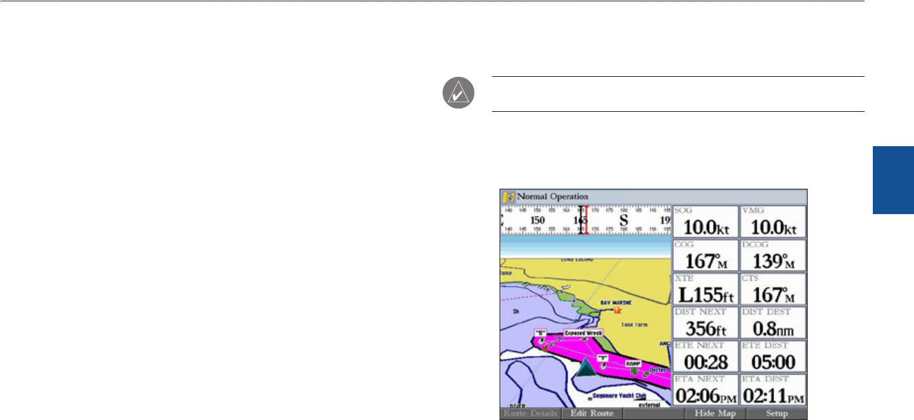
3D Highway Page Options
The 3D Highway Page provides access to functions and features relating to the
3D Highway Page (or Highway function window) using the ADJ key and soft key
options.
The available ADJ soft key options are Route Details, Edit Active Route, and
Setup. As you add optional hardware to your GPSMAP 3006C/3010C or Garmin
Marine Network, adjustment menu choices may appear automatically. You can
also customize the 3D Highway Page to show other functions and different sizes
or types of Digital Data elds.
• Active Route Details (Route Details)
—shows details such as distance,
course, and other useful information for each waypoint of the active route.
• Edit Active Route (Edit Route)
—allows you to review and modify the
Active Route from either a list of the route points or on a map.
• Setup
—allows you to select what waypoints and tracks are shown on the
3D Highway Page. Use the ROCKER and ENTER keys to select or clear
options. The following options are available:
•
Active Route Waypoints—shows all active route waypoints.
•
User Waypoints—shows only nearby waypoints.
• Track Log
—shows the current active track log.
• Saved Tracks
—shows any saved track logs.
Showing or Hiding Maps
When using optional preprogrammed BlueChart g2 data cards, you can view the
map on the 3D Highway Page.
NOTE: The Show/Hide Map feature is available only if you are using an
optional preloaded BlueChart g2 data card.
To view map on the 3D Highway Page:
PresstheShow Mapsoftkeytoshowthemapcartographyonthe
3DHighwayPage.PressHide Maptoreturntothehighwayview.
Show/Hide Map (Using Optional BlueChart g2)